Results 11 to 20 of 659
Thread: Upcoming Typhoon: TS Seniang
-
12-01-2014, 08:34 PM #11
-
12-01-2014, 08:43 PM #12
lahi2x man ang forecast,, sa US lahi mu re curve northwest to spare sa phils. pero ang japan forecast s mu landfall visayas-luzon areas.. hopefully mas sak2 lng ang US ma spare ang ato nasod..
-
12-01-2014, 11:15 PM #13
-
12-02-2014, 12:38 AM #14
According sa Accuweather two scenarios possibling mahitabo..either mosaka padulong japan or central philippines... better be prepared and informed... and pray.
-
12-02-2014, 12:42 AM #15
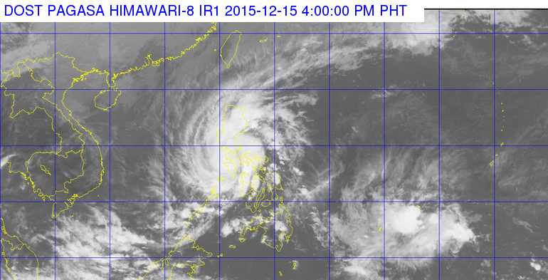
source: pagasa website. murag calm raman..may tag di na tinood

-
12-02-2014, 01:11 AM #16
source: JMA.

Should we be worried? Maybe. Layo pa kaayo ang bagyo, pwede pa mo kusog ug maayo or mo hinay. Remember, Yoli started roughly the same area as this one...

Last edited by ghostie2472; 12-02-2014 at 01:13 AM.
-
12-02-2014, 08:50 AM #17
-
12-02-2014, 08:58 AM #18
read somewhere that the condition is perfectly just right for another 3-4 Typhoon. And JMA's forecast seems visayas na naman ang pinaka-ideal nga path based on given data..
Pastilan, ang uban wa pa kabangon intawon sa kang Yolanda and even kang Queenie...
-
12-02-2014, 09:30 AM #19
I'm not trying to scare anyone here.. pero.. Last year's Yoli trajectory released by JMA, accurate bya ang JMA ato.. BUT let's hope nga JMA is wrong sa path ani nga weather system.
-
12-02-2014, 09:48 AM #20
of all the weather sites within the vicinity of this typhoon only PAGASA has no updates. its the Phils who will be most affected by this if ever, but then PAGASA site is as clear as the bright blue skies.

and in Chinese site, all i can see is the 10 dashed line in their map. who cares about the typhoon what they care about is the island in the west Phil sea.
Advertisement
Similar Threads |
|


 Reply With Quote


