


You swoop over the countryside like a bird in flight, the buildings and fields passing in a blur as you flick back in time between one month and the next.
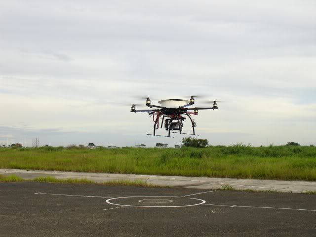
But this isn't just another upgrade to Google Earth. You created this yourself just 30 minutes ago using a small, cheap drone that took a series of simple photos while airborne. This is the idea behind Pix4D, a new spin-off from EPFL in Lausanne, Switzerland, which is stitching together thousands of 2D photos to create complex 3D models that are navigable over time.
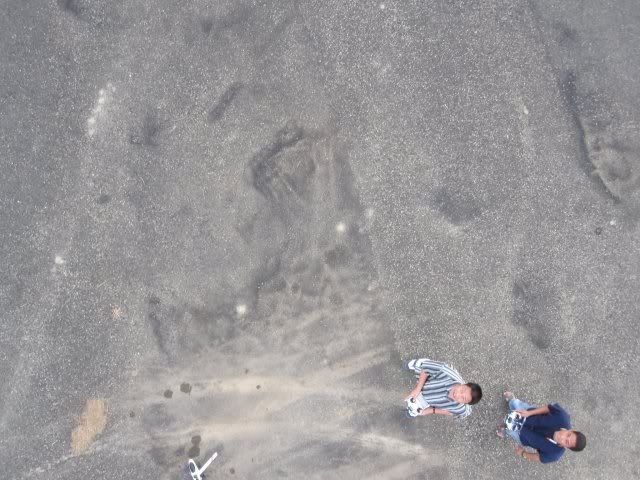
The process starts by flying a simple aerial drone over the area that is to be mapped, taking hundreds of photos as it passes. The GPS location for each photo is stored, as is the angle at which it was taken. An algorithm then detects points of interest - such as areas of high contrast between pixels - in each photo and uses these to stitch the photos into a single image, much as you'd piece together a jigsaw.
This is all created in the cloud, too: presumably to spare anyone who buys the finished product from having to deal with all of the heavy processing that's required.
One Per Cent: Drone's 2D photos converted to make 3D models
YouTube - ‪Turn 2D photos into 3D models‬‏
http://pix4d.com/
-RODION
Results 1 to 10 of 16
-
05-27-2011, 09:12 AM #1
 Drone's 2D photos converted to make 3D models
-
05-27-2011, 09:48 AM #2 Re: Drone's 2D photos converted to make 3D models
somebody here in cebu made a drone for aerial pictorial. he designed the drone himself. more like atong naa sa 3 idiots. nindot jud kaayo. my friend is flying an RC 450 helicopter, then the drone shoot footage above the chopper. so nice.
-
05-27-2011, 09:53 AM #3 Re: Drone's 2D photos converted to make 3D models
Unsa nay latest sa drone sir Skulls? Was he supported by any organization?
 Originally Posted by THE SKULLS

-
05-27-2011, 10:05 AM #4 Re: Drone's 2D photos converted to make 3D models
He sold it to a US firm in Malaysia or Thailand. I will ask the a friend personally to provide clearer details. have you seen 3 idiots? kato drone na gi-trabaho nila? ingon adto pero propelled by 6 siya. nindot kaayo oi.
wala ko ani sa ila pagpalupad, pero nakakita ko sa video taken from the drone. nindot kaayo no.Last edited by THE SKULLS; 05-27-2011 at 10:11 AM. Reason: uploaded photos
-
05-27-2011, 10:13 AM #5 Re: Drone's 2D photos converted to make 3D models
^
Very interesting pictures.
Sayang gibaligya. Unsa'y gibaligya ang idea(specifc features) or a drone lang itself (ug design)? Originally Posted by THE SKULLS
-
05-27-2011, 10:15 AM #6 Re: Drone's 2D photos converted to make 3D models
dili ko katubag ana hands. but I will ask from a friend. Originally Posted by handsoff241
UAV diay term ani.
just watched the video from my FB account.
basin naa ni sa youtube.
pagkanindot jud.
nindot jud resulta ani kung ma-integrate sa software para mapping.
labi na tingali HD or high resolution ang camera.
-
05-27-2011, 12:05 PM #7Junior Member


- Join Date
- May 2011
- Gender

- Posts
- 31
Re: Drone's 2D photos converted to make 3D models
wow ka nice ani gud...
-
05-27-2011, 12:49 PM #8C.I.A.

- Join Date
- Oct 2008
- Gender

- Posts
- 2,738
Re: Drone's 2D photos converted to make 3D models
nindota oi. kwarta jd cya ato bro
-
05-30-2011, 07:54 PM #9 Re: Drone's 2D photos converted to make 3D models
kwarta jud to. Originally Posted by brandnewbien
@ rods
freeware ba ning software gamit ani?
-
09-19-2016, 04:47 PM #10Newbie
- Join Date
- Aug 2011
- Gender
- Posts
- 5
Boss Rodion, if ever nay ipa convert.. mo.convert pud ka? then pila pud? unsa output niya? hope naa reply murag dugay2x na baya ni nga thread hehehe

 Reply With Quote
 Advertisement
Similar Threads |
|
 Posting Permissions

|